Tuesday, September 1, 2009

Ending August in rain and snow on Sable Mountain

As the colors have begun changing I have been trying to get into the park anytime I have a chance. Unfortunately the weather has not cooperated too much. The other day at Savage River wasn't too bad and though Saturday the 29th was pretty nice, as the pictures will show, Sunday the 30th was pretty nasty.

I started out taking the first possible shuttle bus into the park at 6:15am. The weather was gray and overcast, and looked like it could begin raining at any moment. Nature didn't disappoint. Minutes after entering the park rain began to fall and wouldn't stop until sometime the next day.

I stepped off the bus about 45 miles into that park at Tattler Creek. I hiked up Tattler Creek for about 1.5 miles before finding the ridgeline that I scrambled up and would follow to the summit of Sable Mountain. During the approach to Tattler Creek the cloud ceiling was above the Polychrome Glaciers and Cathedral Mountain so I was optimistic that Sable Mountain might be in view, unfortunately I was wrong about this. The summit to Sable Mountain sat in clouds and I couldn't remember what it looked like from previous travels in the park.

So I set out, unsure of where the top was or what it looked like. I figured I'd hike and have fun, and turn around when things stopped being fun or safe.

The going was great. Tattler Creek was mellow and had multiple social trails accompanying its path down from Sable Mountain. As I moved up I kept an eye out for bears and Dall sheep. Though I saw no bears on the way, shortly after finding my ridge line and climbing up it I found a group of 16 Dall sheep on a neighboring ridge line. Another quarter mile or so, I found another herd and shared my path with three young Dall rams (the picture only shows two, because the pictures I took of all three were pretty unsteady and blurry).

Sable Mountain rises well above some of the neighboring hills and mountains and offered some killer views. Shortly after these views though I entered the clouds and bits of snow on the ground. I hiked through clouds and varying degrees of snow for the next thousand feet or so. I'm not sure I hit the summit, but later this week the weather looks like it should improve so perhaps Sunday will be a good day for it, though I would like to make a fast and light run up Double Mountain too.

I turned around after finding that the ridge line was descending extensively, visibility was getting pretty bad, and the wind was getting stronger. The hike back was uneventful and descending to Tattler Creek saw the rain come down harder. At the road, I caught the camper bus with the surly bus driver Alan and traveled to Eielson Visitor Center to see how the fall colors looked. Unfortunately Eielson was totally fogged in, so I caught the next eastbound bus back to the WAC.

Special thanks to the Italian and Israeli tourists who helped me open my granola bar in the bus. My numb hands weren't working too well :)

Thanks also to Mike and Leslie from work for the ride back to the chalet from the WAC!

Friday, August 28, 2009

August 27th: Evening Run and the best sunset ever!

Today started like most days do out here for me. I began the morning at 6am, with a good, long toothbrushing before negating that work by heading out to Black Bear Coffee for some delicious Raven’s Brew drip coffee. I enjoy 2-3 cups of thick black coffee while reading and waking up each morning before catching breakfast at the Employee Dining Room (commonly referred to as “the EDR” acronyms aren’t just for the military). I then head to work at about 8am and begin ‘working’ and gazing up at Mt. Healy, which the warehouse sits in the shadow of.

Today was a bit different, because the weather was amazing (sunny with a high around 60°F) after a week or so of rain and gray. I also had a phone interview with Boise Cascade at noon. The phone interview went well. I will hear back from them in a week or so to see if they want to give me a face-to-face interview.

I clocked out of work at about 4:45pm, ate dinner, and though I was a bit worried about how my knees would feel I headed out into the brightly colored vegetation for a run at around 8:30pm. I was pleasantly surprised by how good my knees felt, no soreness to speak of. My quadriceps were a bit sore as it turned out, but nothing more than minor fatigue from the previous day’s hike. So I continued. This was the best decision I could have made.

I was treated to a very nice sunset over Mt. Healy for the first two miles of my run. The scattered clouds appeared a dark blue, but the edges burned a golden yellow. It was very striking, but it was at about 2.5 miles in to the run that I was blown away. The foothills of the Alaska Range (which are drastically underestimated calling them ‘hills’ as they are quite large) block out a good bit of the sun when it gets low on the horizon; however, where the sun gets through, shining south east, seems to funnel and concentrate the remaining sunlight.

A large section of the southern horizon had big, grey ominous storm clouds, which were lit up the darkest, strongest pink color I had ever seen. Further more, one section of these clouds were raining, diffracting the pink sunlight into three-color bands. The first color band was the largest and shone a vivid red color, while the smaller second and third bands were bright yellow and bright orange. The beauty of this sunset was amazing and was by far the most incredible I have ever seen!

It existed for 5-10 minutes before dimming out as the earth rotated and the Alaska Range shut off the vivid pink light. At mile 3, I turned around to head back home and watched the last bit of sunlight eeking by the north side of Mt. Healy also fall victim to the earth’s rotation.

The last 3 miles of my run continued on tired legs, a brain stirred by the combined probabilities of the natural events that had just occurred, and a heart shaken by the awesome beauty of this place. This display fell in the same direction as where much of my thoughts of late have been, specifically ‘south’. Though there are many places I still hope to see, a little voice deep in the back of my head has begun to whisper, “go home.”


(Naturally I did not have my camera for this event. I don't take it running, but perhaps in the future I will take it)

August 26th: Mt. Margaret and Primrose Ridge


Today finally saw the hiking of Mt. Margaret. Myself along with my friends Mark, Lucy, and Jesse set out at about 1:30pm. It was another rainy day and the drive to Savage River, where our path began, was through some pretty low clouds, but the rain was holding off.

As we began hiking up Mt. Margaret we began climbing through clouds. The clouds were a little misty and did nothing more than slightly dampen our clothing, which for me was a 100% cotton hoody (a poor choice!). After getting to the top of Mt. Margaret we had some snacks, donned rain jackets, and continued along the Primrose Ridge line. The ridgeline was big and wide, and marshy in spots. “Termination dust” was melting throughout various spots on the ridge line (termination dust gets its name from its presence meaning the end of summer). The Dall sheep have begun herding up (something they do for their winter migration to increase security of the group) and we saw two large groups of them on different areas of the hike.

This hike was a lot of fun, because though we were in clouds much of the time, breaks would occur in the clouds providing us tremendous views of the autumn tundra. The changing of colors in the tundra is incredibly pronounced due to the fact that much of the ground cover turns shades of red, while the cotton woods, willows, and spruce turn shades of yellow and gold. Interspersed with these is the black spruce, which remains green throughout the year. The effect is out of this world, producing vivid fall colors that immediately reminded me of those seen annually in the Pacific Northwest (arguably the best place for viewing autumn color changes. That’s right New England I said it).

On the drive home we saw two big moose a cow and bull. The bull had a big ol’ set of antlers that were naked of their velvet. The drive from Savage River (Milepost 15) to the entrance of the park takes visitors right through moose rutting country (rut: noun, a period of increased sexual activity during which the males fight each other for access to the females, commonly known as ‘the rut’). Unfortunately, we saw no agro bull moose bashing their antlers into each other, but I am heading out to Eielson this weekend and am optimistic

Sunday, August 16, 2009

More photos

Here are some photos taken by Zach during the recent multi-day hike in/around the Toklat River basin and Kantishna. He is a great photographer. Some of his work can be sampled at:

http://kaptivephotography.com/main.html

Zach is a solid guy and a total adventurer. Enjoy!

Tuesday, August 11, 2009

Days 3 and 4: Kantishna

I have decided to combine the reports of the 3rd and 4th days of the trip, because of extensive bus travel and these are the least documented in photos due to the wet weather.

On the night of day 2, we all rigged for night time rain. The weather looked like it might get bad over night, but other than a little bit of rain and some wind we came through the night pretty dry. As the previous morning, I ate a quick breakfast of oatmeal and granola, and broke camp quickly. This morning though I set to hydrating while purifying water for the day's travel.

Shortly before departing camp I happened upon what appeared to be a big porcupine. This all occurred by accident, when I heard a sort of hissing sound and saw this mound of creature. Now, I have seen porcupines before; on the Bowron Lake circuit I saw one swim across a lake and he was pretty small. About the size of a opossum, but with all the prickly porcupine bits. This guy was much different. Big, he was sitting, kind of coiled up looking, like he might jump, and looked to be in a ball about 2.5 feet across. He was all black too. Judging from the sounds he had made and the way he watched me I am guessing he wasn't all that friendly. With this in mind and the fact that he has all these pointy little quills that I didn't care to come into contact with I gave him a wide berth. I tried to capture some pictures, but they all came out pretty poor. The best is shown on the right.

On leaving camp we headed south along the main branch of the Toklat River. Walking along the bed, we had to cross many braids of the river. This was all glacial and (as could be guessed) quite chilly, but we never saw much water higher than knee high, so all in all the crossing was uneventful. We made it to the Toklat Visitor Center around 1pm. This is where me and Zach bid farewell to Mark and caught the bus to Kantishna. Before Kantishna, we stopped at the Eielson Visitor Center, which is where I snatched this photo of two moose skulls. Apparently these bulls got interlocked during the rutting season where they challenge each other for mating rights. One got a fractured eye socket and both eventually became critter food.

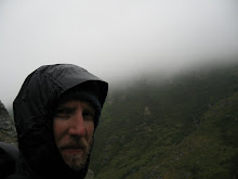
It was here at the Eielson Visitor Center that the weather really started heading south. Eielson looked amazing. I'm really hoping to get some exploring done out here. I've got a cool multi-day hike that would be fun through here, but my split days off at my crappy job may prevent that. Below are some pictures from Eielson.

Kantishna is a district near the end of the park road. Kantishna was originally a mining town (a "not so successful" mining town as the bus driver Scott would say), which was used to explain the presence of abandoned cars, barrels, equipment, and junk. The weird thing is that all of this stuff was of 1970s build and later. Most of it looked pretty functional, not rusty or covered in weeds or anything, which gave the area the feeling of a functioning deep-backwoods redneck village. There was an outhouse even. We didn't stick around long, nor did we take pictures. This place was far creepier than seeing a bear on our ridgeline.

We disembarked from the bus at Eldorado Creek, which is only a couple of miles from the very end of the park road. We hiked through a steady drizzle and with full rain gear on we spotted a trail up a nearby hill to the south of the park road. After getting past the redneck village, we failed to meet up with this trail, but liked the idea of going up the Eldorado Creek. This turned out to be one of the most fun portions of the entire four days!

Moving up Eldorado Creek we found there to be a bit of a road or path (possibly for horses) that was broken up by the creek frequently. This required us to find ways across the creek, often hopping from stone to stone to get across. We did this for a mile or two. It was great, the red rocks of the creek, steep tundra hills to the left, and steep rocky walls to the right provided a beautifull setting for some exploration reminiscent of being a kid again.

We eventually got to a spot where the tundra hills on the left weren't so steep, so we found our path and began climbing. We were immediately met with the welcome sight of ripe blueberries and the unwelcome sound of mosquitoes buzzing. The hills were covered in thick, soft moss that gave anywhere from 4-10 inches when you stepped on it. I looked forward to sleeping on it, but that would be many mosquito bites from now.

We climbed the hill slowly swapping between eating blueberries, hiking up, and looking for clear-ish, flat-ish land for a camping spot. This wasn't easy. For one, clouds had moved in and the hill we were standing on was only visible for another 200-300 feet higher, which wasn't far. For two, there was a lot of willow brush everywhere. With the memory of "that area looks clear" from yesterday's campsite finding, we were skeptical of any site seen from a distance of over 300 yards. As we explored the hills connected to the one we were on we were pretty well disappointed with our prospects.

We eventually bushwhacked through a small valley and found a decent site. I say decent because the the site had two large negative aspects. The first was that it wasn't too flat. We both ended up in a feet down sleeping position and more than once I found that in the night I had slid down to the foot of my tent. The second negative aspect, and this is a biggy, is that this site by far had the best blueberries of any we had seen to that point. Not wanting a close encounter with a bear, but wanting to eat and get to sleep (it was getting late, past 10pm if I remember correctly) we slept with bear spray close at hand, picked as much of the blueberries as possible, and stored our packs (with the picked blueberries) over 100 yards from our site.

This turned out to be adequate as we had no bear encounters. We decided the night before to forego breakfast for a couple of reasons. The reasons being that we wanted to conserve water due to the fact that the creeks we were near are contaminated with heavy metals, we wanted to conserve time to catch the early bus out of the park, and we had some snacks to tide us over until we got a long enough bus stop to cook breakfast (this would be at Eilson).

We broke camp early and after finding the trail from the night before made it to our Eldorado Creek crossing near the bus stop in record time. Unfortunately we needed this extra time. Zach lost some wet footwear and his bear spray during a mild fall on the trail down (it was muddy), but he was able to backtrack and get them, while I munched on a 2 of my 3 granola bars :)

We caught the bus and began the 65 mile drive out of the park. About two miles after getting on the bus we saw this moose, which was neat. It would have been neater if he would have stood up. Then we ate the most amazing oatmeal at Eilson Visitor Center. We added the blueberries from the day before and devoured the oatmeal in probably about a minute flat. Amazing!

We got back to the Wilderness Access Center at around 3pm. Here I bid Zach farewell. It looked like he had acquired a trip back to Anchorage pretty quickly. This was good, because we were a little worried about how hitchhiking would go for him, considering he was soaking wet and without a shower in over four days :)

Sunday, August 9, 2009

Day 2 of 4: Polychrome Mountain Exploring and Toklat River Camp


After a chilly and rather restless night, I rolled out of the sleeping bag around 7:00am and cooked myself some oatmeal. During breakfast, a golden eagle soared overhead. He must have smelled my oatmeal! While Zach and Mark slept I broke camp and got to work on getting my pack arranged better. Unfortunately there is just really no good spot for the damn bear canister. Try #2 had me putting it on the bottom of the pack (Spoiler Alert: This didn't work very good either!).

Setting out today we headed east towards Polychrome Mountain. This mountain stands on the north side of the Polychrome Glaciers that I hiked towards earlier, on my day hike in the Polychrome area. Summitting from the south side of the mountain is undesirable due to the high relief and excessive amount of scree (like all mountains and hills here). So we thought we might give it a try.

We started with our packs, which became undesirable quickly (scree+heavy packs+steepness=tiredness). We moved to a nice flat tundra clearing where we ditched our packs and took small loads (snacks and water) before continuing on. We continued another 1000 feet or so before the wind became really strong. We also found that the ridgeline we hoped would take us to the summit didn't connect like we hoped and going this way would likely lead to a late return to the packs. Oops!

Returning to the packs we headed east. This entailed fighting through a lot of willow bushes, which made the going slow and scratchy. We had viewed a couple of distant plateaus that looked hospitable and like possible camping locations, however upon reaching them we found they too had a lot of brush. This led us to a cool little creek.

Upon entering this creek bed we found mudslides on each side of the creek that had hardened. This area was probably really unstable this past spring. In the hardened mud were the tracks of many different creatures. The two notable sets of tracks were from wolf and bear. This coincided with the wolf cries we heard the night before and many bits of animals found along the creek. Many snow shoe hare were made a meal of along this creek, as evidenced by rabbit's feet deposited regularly.

After hiking a mile or two along this creek it flowed into the main branch of the Toklat River. We camped near the confluence of the creek and the Toklat. In fact, our cooking site was located on a 6 foot high bank of the Toklat, providing an amazing view of the Toklat riverbed and nearby Mt. Sheldon (we referred to this site as "Dinner Time Theater").

As I sat cooking, I was really struck by our day's travels and this park. The wide bed of the braided Toklat River was astrewn with stumps and bits from dead trees. The stumps attracted our gaze due to their resemblance to a passing bear. It was these stumps and thinking about traveling along the creek that I realized just how accelerated the life cycle is out here.

Old growth anything simply does not exist. Animals kill other animals and the drunken forests of black spruce show that even the vegetation isn't immune. In the bushy areas of the tundra, where willow trees clog any path you might find, snow shoes eat the bark and chew off their tips. Often leaving huge swaths scarred and dead (the snow shoe hare population in the park is the highest it has ever been and a crash in the population has been expected every summer for the last five years or so).

Tomorrow at Eielson Visitor Center we will find that not even the strong and vicious are above this life cycle. The angel of death works overtime in Denali National Park!

Thursday, August 6, 2009

Day 1 of 4 in the back country: East fork of the Toklat River


Hey folks! I'm going to this in one day installments, because there is a good amount to cover and because I'm tired. I got back today and have been drying out gear.

The hiking group met up at 8:30am at the Black Bear coffee just outside of the park and consisted of myself, and my friends Zach and Mark. After getting our permit from the Backcountry Permit Office we headed into the park on the 11am camper bus. While on the bus, we saw a lot of wildlife.

Coming around a corner after Savage River, we were met nearly head on by a bull caribou. This cranky fellow ran straight towards us, causing the bus driver to slam on the brakes. The bull then turned around and proceeded to run on the road in front of the bus for well over a mile. It was pretty hilarious really. Later we saw a Grizzly sow with two cubs. One cub really seemed to be mugging for the camera, sitting back and scratching his belly, while his mom and sibling devoured wild berries. Just before our stop at the east fork of the Toklat River we saw a fox too, which was my first.

Our stop was at a bridge that ran over the east fork of the Toklat. After getting down to the river bed we proceeded north for about five miles before heading east. While heading north, we saw many interesting geological formations. The rock walls, especially on the west side of the bank, were really incredible. While hiking up the river bed we saw a bull caribou.

We headed east on a tributary to the east fork and ultimately found a pretty good camping site. After pitching camp and eating dinner, we headed out on a hike up to a ridgeline on the north side of our camp. The views were amazing. The sky was absolutely clear and we were able to get some clear shots of Denali in full alpenglow. We also found a moose antler that was left behind (or removed from) by a large bull moose.

We got back to camp around midnight and settled in for our first night in the backcountry.